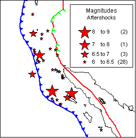
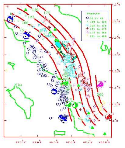
Aftershocks through mid March
It apparently ruptured the section of the Sumatra subduction zone from northern Sumatra
northward for about 1000 kilometers.
Initiation point of magnitude 9 earthquake (star) and aftershocks (from USGS
website www.usgs.gov).
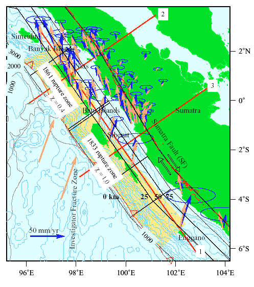
The Sumatra subduction zone is where the Indian plate dives beneath the Asian plate along a fault that dips about 20o into the Earth. Because of the low dip angle, earthquakes can rupture along a very large surface area of the fault, producing such large magnitudes. In fact, the 10 largest earthquakes since 1900 have occurred at subduction zones (see http://neic.usgs.gov/neis/eqlists/10maps_world.html).
The huge and destructive tsunami was the direct result of the earthquake disturbing the seafloor and displacing an enormous volume of water. The disturbance spreads from the epicenter like ripples in a pond but, unlike circular ripples, is stronger in some directions than others due to the nature of the faulting. An animation of the theoretical spread of the tsunami waves (from the Japanese National Institute of Advanced Industrial Science & Technology) can be viewed at http://staff.aist.go.jp/kenji.satake/animation.gif.
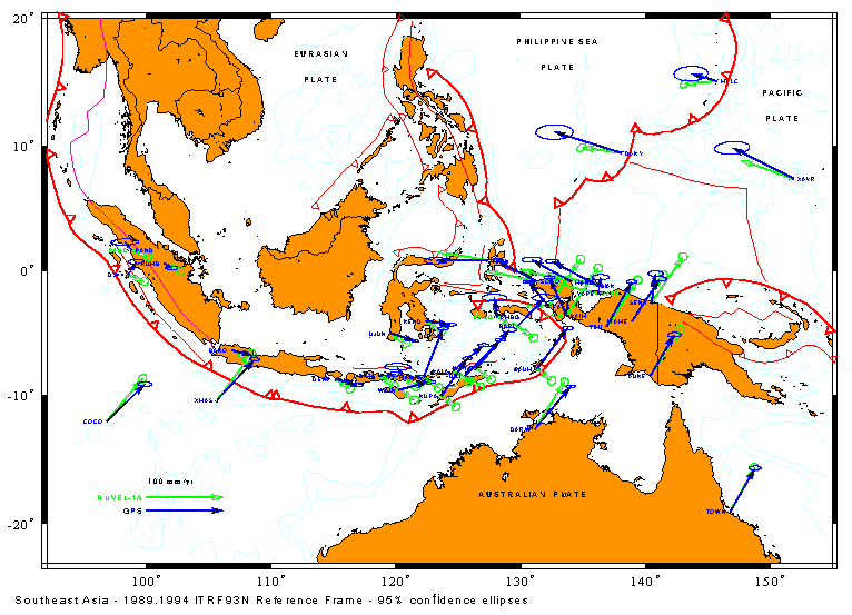
Global Positioning System crustal deformation monitoring
Participants:
RPI: Rob McCaffrey, Colleen Stevens, Peter Zwick
Scripps Institution of Oceanography: Yehuda Bock, Jeff Genrich, Linette Prawirodirdjo
BAKOSURTANAL (Indonesian Mapping Agency): Jakub Rais, Cecep Subarya, Toto Puntodewo
Since 1989, we have been monitoring crustal motion throughout Indonesia with Scripps Inst. of Oceanography and BAKOSURTANAL using the Global Positioning System.
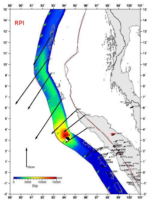
Starting in 1989, we established a more dense network of GPS monitoring sites in Northern Sumatra. These show that the subduction zone was steadily squeezing the island of Sumatra, loading the system for the next earthquake.
Earthquake and volcano monitoring
Participants:
RPI: Rob McCaffrey, Dave Wark, Peter Zwick
Badan Meteorologi dan Geofisika (Indonesian Meteorological and Geophysical Agency): Fauzi, Masturyono, Sutardjo
Volcanological Survey of Indonesia: Sukhyar
Additional research at RPI has focused on the earthquakes in the Indonesian region and on subduction zone earthquakes throughout the world.
This work is supported by the National Science Foundation and UNAVCO.